GigE camera provides real-time images to accelerate rescue
The Technische Universität Braunschweig is developing an automated reconnaissance system to support disaster response personnel. Primary component is the drone Hugin, with a Manta G-917 on board. These drones are capable of providing real-time data and images from the air to a ground-based system so that first responders can make quick and efficient decisions which otherwise would not be available.
The challenge
Complex situation and time pressure
Heavy rain and storms resulting in flooding, have increased significantly in recent years. When large quantities of rain fall in very short periods of time, masses of water overrun sewage capacities in many areas and allow water bodies to rise over their banks, often with destructive force and disastrous effects. Emergency responders on scene, then face the task of coordinating aid and protection measures as efficiently as possible. However, affected areas are often inaccessible, and situations are unwieldy. Real-time data and images from the air, combined when possible with further sensor data on the ground’s condition, for example, would provide emergency responders with valuable information and allow them to intervene where it would be most prudent.
Based on the images, important decisions could be made, and questions answered, such as: Must warnings be issued, are closures required, at which locations are sandbags necessary, and via which routes are these regions even accessible? In the future, the Braunschweig Stadtentwässerung would also like to take advantage of the Braunschweig TU system for long-term observation of flood protection measures and to review prognosis models.
The solution
Exploration system with aerial imaging
Engineers Martin Becker, Simon Batzdorfer and Markus Bobbe of the Institute of Flight Guidance at the Technische Universität Braunschweig (TUBS) and Jan Schattenberg, Hannes Harms and Julian Schmiemann from the Institute for Mobile Machines and Commercial Vehicles, also at the TUBS have taken up this topic and developed an automated exploration system. The DLR Space Administration was promoting the engineers’ project with approximately one million euros funding from the Federal Ministry of Economics and Energy, to work on an exploration system in cooperation with AirRobot GmbH & Co. KG from Arnsberg, Germany. Generating aerial recordings in catastrophe-stricken areas, such as flood zones, using automated, unmanned aircraft plays a meaningful role in the exploration system. A Manta camera from Allied Vision on board the drone Hugin delivers images from the air. Allied Vision’s GigE Vision Manta G-917 camera serves as the drone’s eye. Combined with ground-based systems, information regarding the situation in affected areas can be collected to support emergency responders at the affected location.
In case of emergency, system operation must be fast and intuitive. The system determines the flight path based on just a few parameters, so that the emergency services have as little effort as possible to control the drone. The response team leader can easily choose the area to fly over at the system’s ground station. Flight planning then is automatically performed, incorporating all mandatory parameters e.g. opening angle of the lens, to ensure a minimal defined overlap for photogrammetric processing of the obtained images. The drone follows the flight path automatically, and the (live) evaluation of the images is subsequently triggered automatically, too.
The benefits
Keeping overview and control
During the flight, individual images are recorded from altitudes of usually 100 meters, depending on the application. All obtained images are then processed, to generate a continuous overview of the entire application area. Due to the automatic exposure adjustment functionality of the camera, even changing light conditions are manageable. Since comprehensive image preprocessing (i.e., image optimization, light correction, white balance, color correction, binning, decimation) takes place within the camera, information-rich two-dimensional images are transmitted to the base station, located on the ground. In addition, a self-developed local communication network is used, which enables targeted information exchange, based upon different communication technologies. During catastrophic events, emergency responders can evaluate the situation better and more quickly with the aid of these images. Since they can see where protective measures must be taken or increased, they can initiate the necessary steps.
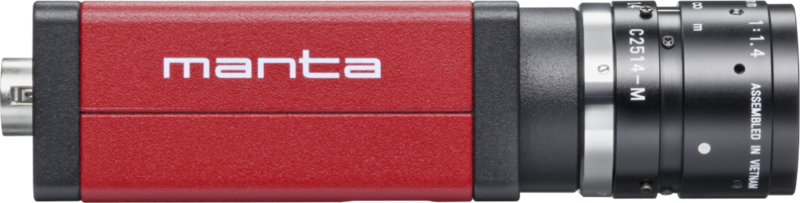
The camera: Manta G-917
High resolution camera with GigE Vision interface
The camera is equipped with a 1” Sony ICX814 CCD sensor with EXview HAD II technology and a resolution of 9.2 megapixels. The sensor distinguishes itself with outstanding image quality and high resolution, which allows inspection of ground objects in fine grained detail. Further crucial criteria for the choice of the camera were the availability of an ethernet connection, as well as the global shutter sensor technology.
Highlights at a glance
Real-time data and images enable fast decisions.
Aerial imaging supports rescue team on the ground.
Manta camera delivers information-rich two-dimensional images.